This atlas of Zhili Province's administrative divisions dates to the ninth year of Xianfeng (1859). It was hand-drawn by Xu Zhidao, an official in Baoding Prefecture, at the request of Hengfu, then governor-general of Zhili. It primarily served as a reference for the governor-general on military affairs, defense, public security, and administration.
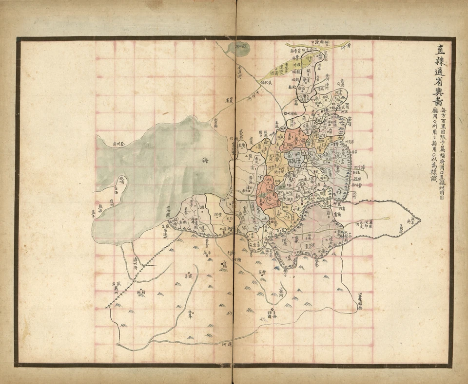
The atlas contains 24 maps: one of the whole province; four of the jurisdictions of Shuntian Prefecture—the Western, Northern, Eastern, and Southern Circuits; nine prefectural maps—Baoding, Yongping, Hejian, Tianjin, Zhengding, Shunde, Guangping, Daming, and Xuanhua; six maps of directly administered departments—Zunhua, Yi, Ji, Zhao, Shen, and Ding; and two maps each for Chengde Prefecture and the Three Subprefectures North of the Pass.
The maps sketch administrative divisions, the Great Wall, mountains, rivers, and main roads. Different symbols mark county seats. South is at the top and north at the bottom, and a distance-based square grid is used throughout. Each county is annotated with the number of villages within its borders, the boundaries of prefectures and departments, and road distances to the capital or neighboring counties.
These maps show how the jurisdictions of Beijing, Tianjin, Hebei, and other places have changed.
Take the Western Circuit of Shuntian Prefecture as an example.
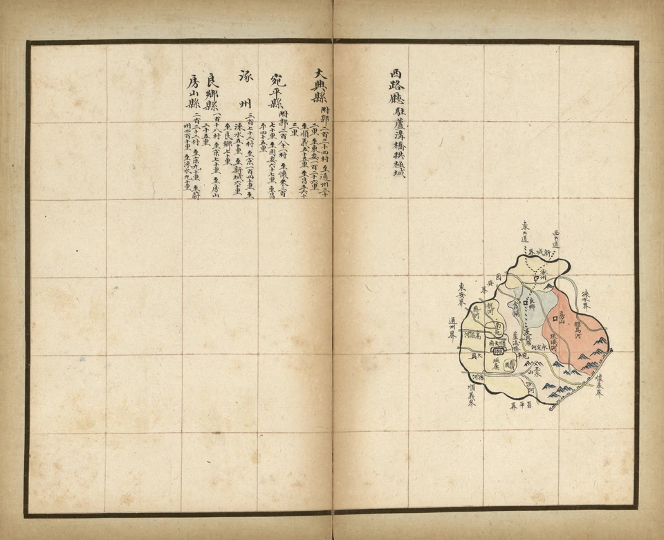
At the lower right is an administrative map of the Western Circuit. Remember to adjust your orientation: south is up, north down, east left, and west right.
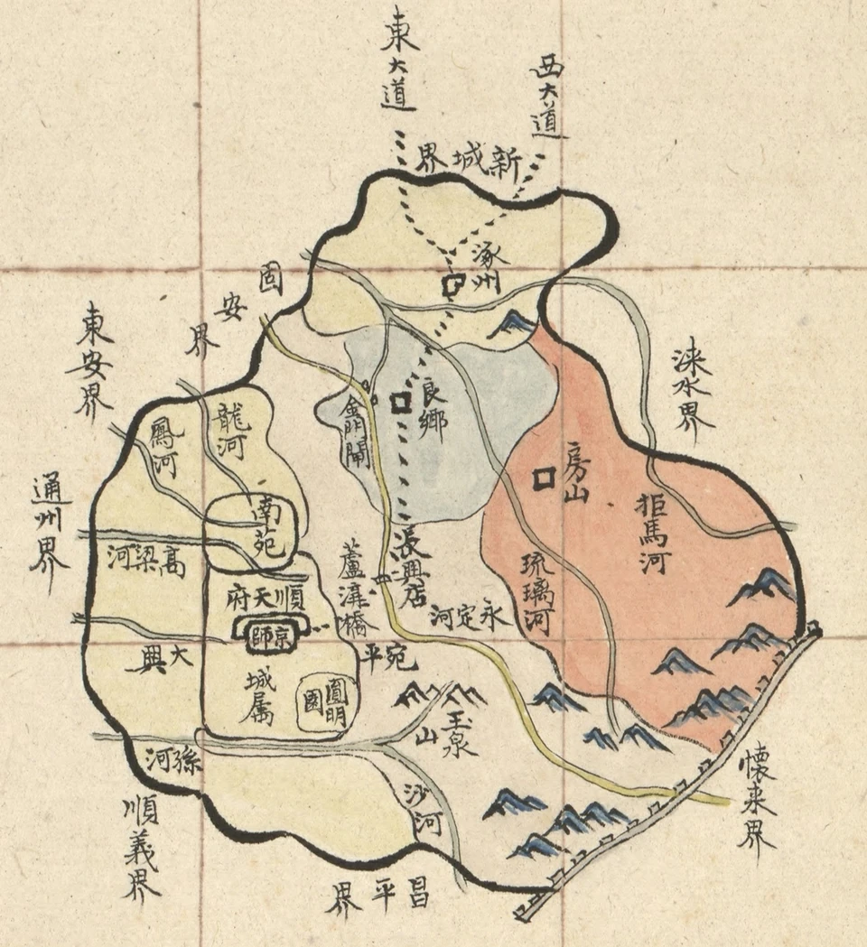
We can see that the Western Circuit then contained the five counties of Daxing, Wanping, Fangshan, Liangxiang, and Zhuozhou. The capital lay in Daxing County. Each county is filled with a different color. Labels around the edges—“Huailai boundary,” “Xincheng boundary,” “Tongzhou boundary,” “Shunyi boundary,” and others—show where the circuit adjoined neighboring prefectures, departments, and counties.
The Yongding, Juma, Liuli, and Sha rivers are visible, along with geographic features and military sites such as Jade Spring Hill, Lugou Bridge, the Great Wall, and the Eastern and Western Highways. All are clearly marked.
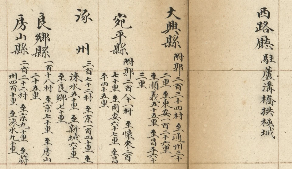
The upper left describes the circuit's counties. We can see that its administrative seat was in Gongji City at Lugou Bridge. It also clearly lists how many villages each county had and its distance to the capital and neighboring counties.
For example, it gives 140 li from Zhuozhou to the capital and 70 li to Liangxiang. I checked on Amap: the route from Zhuozhou's municipal government to Tiananmen along the Beijing–Hong Kong–Macao Expressway is exactly 70 kilometers, and Liangxiang is 36 kilometers away. That is remarkably accurate.
I particularly enjoy studying maps. Comparing historical and modern maps is endlessly entertaining and reveals many interesting things.
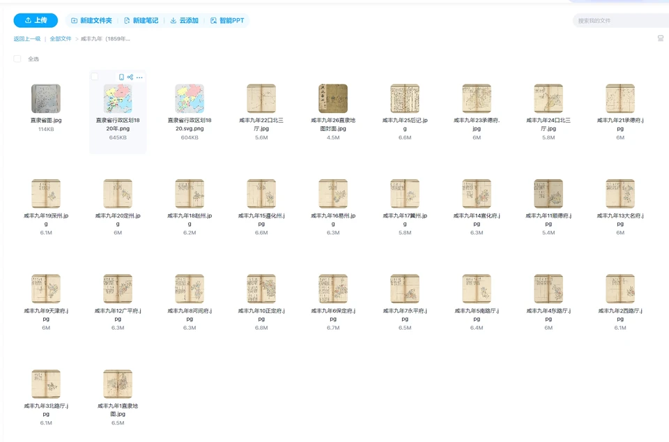
This atlas is now held by the Library of Congress in the United States. Electronic versions are available online, all freely accessible for anyone to download.
Downloading them online is cumbersome, however, and I have already downloaded and organized them. Reply “直隶省地图” (“Zhili Province Map”) to this WeChat public account to receive them directly.
Comments
No account needed. A nickname is required; email is optional. Successful submissions appear publicly without manual pre-moderation.
Comments and nicknames are public. Optional email addresses are not displayed. The selected Waline backend and its hosting provider process comments, nicknames, optional email, IP and browser information. Comments show IP region, without the full IP address or browser and operating system labels. Hosting: Vercel; database: Neon.